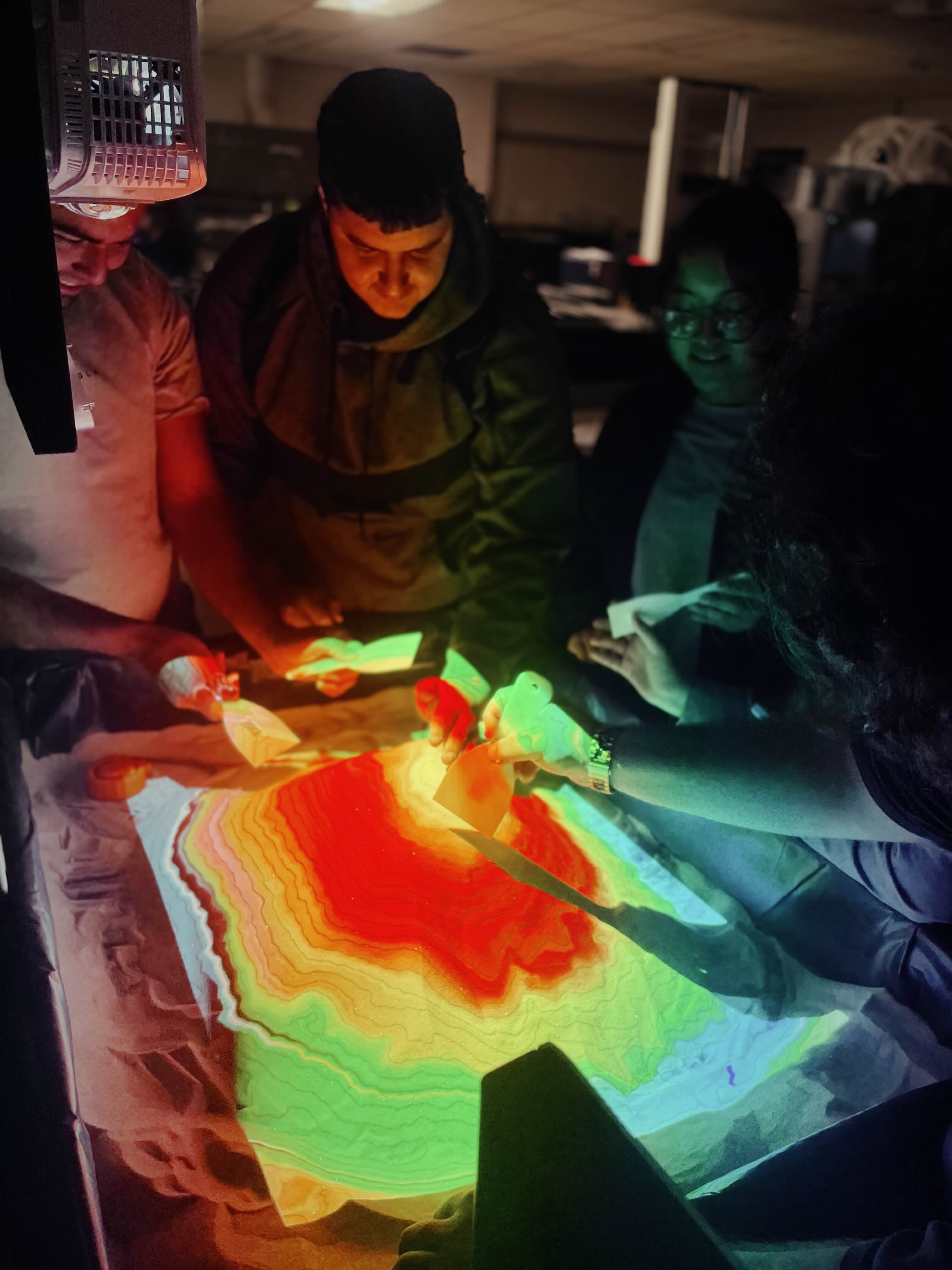
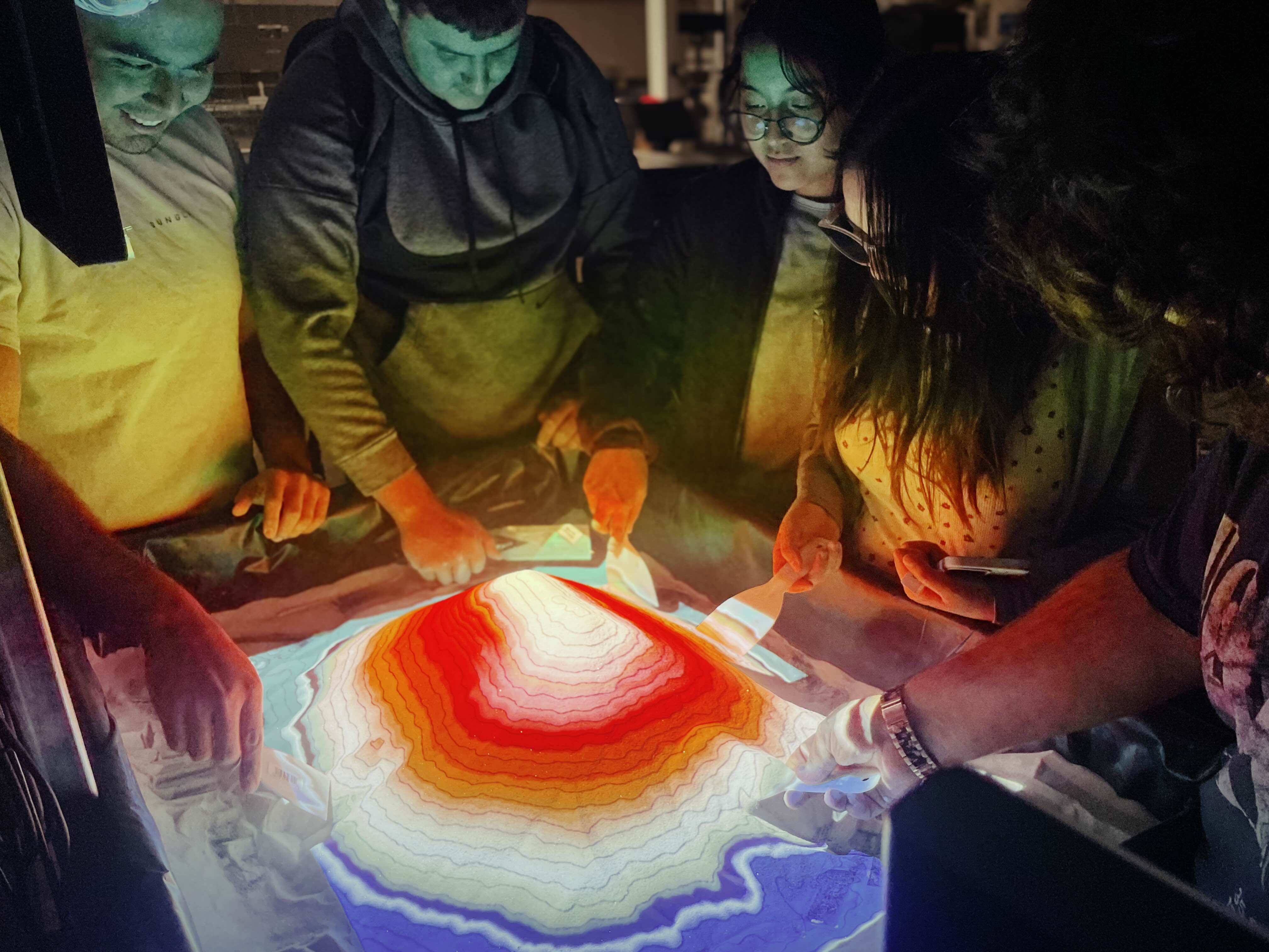
The AR Sandbox is an interactive topographic model built by the Engineering Club
to support geography education at our college. Designed to make learning more
engaging, the sandbox uses a projector and depth sensor to create real-time contour
lines and elevation colors on sand as students shape the terrain. Originally built for
geography classes, it’s also a hands-on tool that anyone on campus can explore to learn
about landforms, water flow, and elevation in a fun, visual way.
Timeline: Janurary 2025 - May 2025
Media
Calibrating AR Sandbox to track changes in the area.
Group of students interacting with AR Sandbox.
Demo of the AR sandbox.
More videos of the AR sandbox.
Contributors
Name
Role
Contribution Highlight
Jared
Club Advisor
Handled ordering of materials such as computer parts
to simulate the AR sandbox.
Kyle
Assembly
Handled ordering of materials
such as ordered structs to create a base for the AR
sandbox.
Aaron
Programmer
Programmed, assembled, and installed necessary components
for the AR sandbox to run.